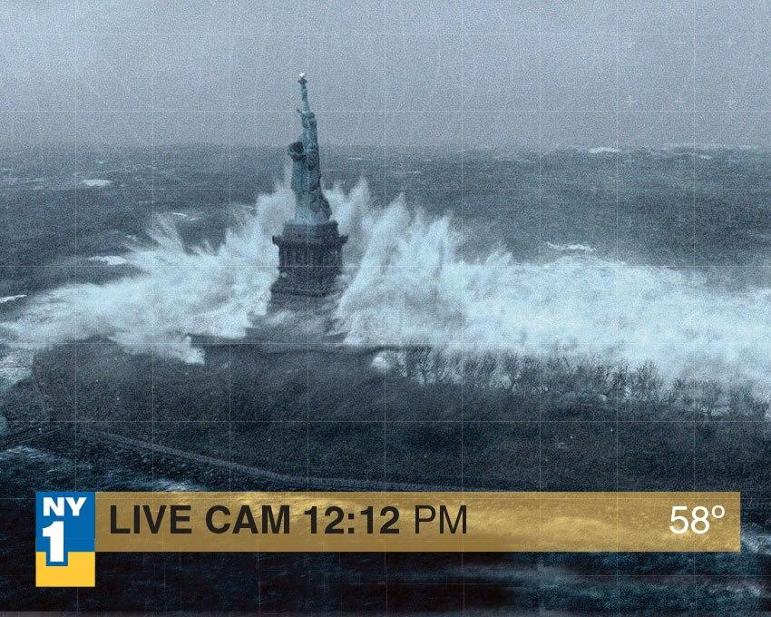
Hurricane Sandy - new weaker storm to hamper recovery possible next week

[quote name='Blaster man']

All I can say is....Wow...

A6ZHVHbCcAAJMHX.jpg
[/QUOTE]

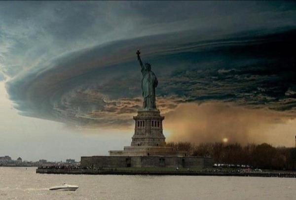
I raise you.

yWpkB.jpg
 
Wind is pretty bad right now, gusts are pounding at the windows and what not. Thankfully the forecast says it'll go to a max of 40mph. It wasn't as bad as last year, especially since the rain started flooding in one window.
 
So, when people say they're underwater on their homes now....;)


Seriously though, home everyone stays as safe and dry.
 
It's officially getting bad at my house. Constant winds for a while but I'm getting some high winds and real high gusts. My from porch has an overhang roof and the gusts are blowing the rain sideways into my door.
 
[quote name='Pookymeister']I raise you.[/QUOTE]

The Statue of Liberty has MAGICAL POWERS? Or is really Storm in statue disguise?
 
Things have been very wet here (western NY) or "upstate" as all you NYCers like to call us :) for the last few days. Now its starting to get a little breezy and unfortunetly we are in the "likely" area of power outages according to the weather channel, so i have my Ipod touch, iphone, ipad, nintendo 3ds, and portable shaver all charged. I still need to check on the little things like food, water, batteries, flashlights, ect. But hey if i do lose power at least i can play games, movies, music and groom myself :)
 
A neighbor's tree fell already... not a good sign considering we are a few hours away from the strongest winds and it has been getting worse by the minute (stronger and steadier gusts).

We removed some extremely large trees from our property last year and in hindsight it was a great move. The way I see it there is only one tree nearby that could fall and hit my house and do any sort of damage... and we'd have to be really unlucky for it to fall in our direction.
 
[quote name='mrmagoo1974']Things have been very wet here (western NY) or "upstate" as all you NYCers like to call us :) for the last few days. Now its starting to get a little breezy and unfortunetly we are in the "likely" area of power outages according to the weather channel, so i have my Ipod touch, iphone, ipad, nintendo 3ds, and portable shaver all charged. I still need to check on the little things like food, water, batteries, flashlights, ect. But hey if i do lose power at least i can play games, movies, music and groom myself :)[/QUOTE]

This is a man with his priorities in order. Hear hear!
 
Found my psp charger that's been missing and just plugged that sucker in - already have DS charged and my phone.

along with some candles and some boardgames, i'm set.
 
I'm 15 miles north of Boston and the lights have been flickering every few hours. Charging up the PSP right now...lolz.

[quote name='Strell']Inlines + giant umbrella. Get on it, son![/QUOTE]
I'm pretty sure he prefers quads.:D
 
yeah, my lights have been flickering and we must have lost power for a split second because the TV shut off and the clock on the microwave needs reset. iPad, iPhones, DS and PSP are all charged.
 
Same here. Lights are starting to flicker, but power is still on, thank God. Wind is insane though. Just hoping for the best for everyone around here. Poor people who own homes at the Jersey shore.
 
http://www.washingtonpost.com/blogs/capital-weather-gang

Hurricane Sandy has a date with the coastline. But, after that, the center keeps getting closer to the Washington area, so this whole wind storm is still kicking into high gear. Sandy is moving quite rapidly now, toward the west northwest around 27 mph. On this course, it should come ashore near Cape May, NJ, sometime within the next few hours.

Rain covers the entire region and there’s no reason to think that’s going to change any time soon. In fact, stronger bands beginning to rotate into the area from Delaware and northeast Maryland should bring with them periods of even heavier rain as well as higher wind gusts.

We’re entering or about to enter into the 12-hour window that is likely to contain the highest gusts. These quick bursts of wind, driven by often blinding rain, could deliver 60-80 mph speeds for a short time and perhaps multiple times. Add in a sustained wind peaking near tropical storm force (39+ mph) and increasingly saturated soil — a recipe for tree failure.

Do not go out unless absolutely necessary. If you are out, try to stay as far away from trees as possible.

1225v1_20121029-SandyVIIRS-IR.jpg


Regarding the coastline, CWG’s Justin Grieser writes that “record extreme” coastal flooding is expected from the Delaware Bay northward through New York City and southern New England.

And back to our west, in the elevated areas of the Appalachians, the blizzard is getting underway. 1-2” per hour snowfall rates are getting going in the higher elevations and as the evening progresses those rates may even increase past 2” per hour!


----------------------------------------------------------------SEPARATOR----------------------------------------------------------------------------------------------------------

http://www.washingtonpost.com/blogs...icane-sandy-news/?hpid=z2#liveblog-entry-3215

As Hurricane Sandy barrels west-northwest toward the southern New Jersey coast, violent onshore wind and waves will continue bringing dangerously high water to much of the mid-Atlantic and Northeast coast.

The National Weather Service is forecasting “record extreme” coastal flooding along the New Jersey coast and Delaware Bay during high tide around 8 p.m. this evening. In Atlantic City, NJ, a storm surge of 3-4 feet is forecast to bring water levels between 9-10 feet above average. Similar tide levels are expected from Cape May, N.J. down to Rehoboth Beach, Del.

In New York City, a coastal flood warning is also in effect, with a 3-5 foot storm surge on top of astronomical tides expected overnight and into early Tuesday morning. As of 2 p.m. Monday, Kings Point, N.Y. has already recorded a storm surge of 3.5 feet, bringing the storm tide as high as 12-13 feet. As of this posting, the storm surge in Battery, New York is 5.7 feet and rising. Also, 23-foot waves were observed at the entrance to New York Harbor.


----------------------------------------------------------------SEPARATOR----------------------------------------------------------------------------------------------------------


mcd2091.gif


MESOSCALE DISCUSSION 2091 NWS STORM PREDICTION CENTER NORMAN OK 0151 PM CDT MON OCT 29 2012 AREAS AFFECTED...APPALACHIAN MOUNTAINS OF FAR WRN MD...WV...AND PARTS OF WRN VA CONCERNING...BLIZZARD VALID 291851Z - 300045Z SUMMARY...BLIZZARD CONDITIONS WILL DEVELOP AFTER 21Z WITH SNOWFALL RATES INCREASING TO 1-2 IN/HR...AND LOCALLY HIGHER RATES ARE ANTICIPATED. THESE CONDITIONS WILL CONTINUE THROUGH THE EVENING HOURS...WITH THE HIGHEST SNOWFALL RATES AND STRONGEST WINDS ANTICIPATED FOR ELEVATIONS AOA 2000 FT. DISCUSSION...OBSERVATIONS INDICATE A MIX OF RAIN AND SNOW ONGOING AS OF MID AFTERNOON OWING TO THE UPSLOPE FLOW REGIME -- I.E. 20-30 KT OF NWLY FLOW SAMPLED BY THE CHARLESTON WV VWP WITHIN THE 0.5-1-KM LAYER. INTENSE LARGE-SCALE ASCENT ASSOCIATED WITH THE INTERACTION BETWEEN HURRICANE SANDY AND A MID-LEVEL VORT MAX OVER THE CAROLINAS WILL YIELD A MARKED INCREASE IN PRECIPITATION RATES LATE THIS AFTERNOON AND ESPECIALLY INTO THIS EVENING. ASSOCIATED ADIABATIC COOLING WILL ALLOW SNOW LEVELS TO LOWER...WITH SNOWFALL RATES INCREASING TO 1 IN/HR FOR ELEVATIONS AOA 2000 FT AFTER 21Z. HIGHER RATES TO 2 IN/HR /LOCALLY HIGHER/ WILL DEVELOP AFTER 00Z. THIS WILL OCCUR AS ASCENT IS AUGMENTED BY WAA AND STRONG FRONTOGENESIS OVER THE FRINGES OF THE WARM CORE ACCOMPANYING BECOMING-POST-TROPICAL CYCLONE SANDY...AND NOCTURNAL BOUNDARY-LAYER COOLING TAKES PLACE. NAM/RAPID-REFRESH FORECAST SOUNDINGS INDICATE A NEARLY 100-MB DEEP DENDRITIC GROWTH ZONE DEVELOPING WITHIN THE MID-LEVELS...ATOP -2C TO -4C ISOTHERMAL LAYERS IN THE LOWER LEVELS...SUPPORTING THESE HEAVY SNOW RATES. AS THE LOW-LEVEL PRESSURE GRADIENT INCREASES IN RESPONSE TO THE APPROACH OF SANDY...0-1-KM MEAN FLOW WILL INCREASE TO 45-50 KT AFTER 21Z. AS SUCH...SUSTAINED NWLY/WNWLY WINDS OF 35-40 MPH WITH GUSTS REACHING 60 MPH ARE EXPECTED...STRONGEST OVER RIDGE TOPS. VISIBILITIES WILL BE REDUCED TO BELOW 1/4 MILE WITH BLOWING SNOW...RESULTING IN BLIZZARD CONDITIONS. THESE CONDITIONS WILL CONTINUE THROUGH THE EVENING HOURS.


----------------------------------------------------------------SEPARATOR----------------------------------------------------------------------------------------------------------


----------------------------------------------------------------SEPARATOR----------------------------------------------------------------------------------------------------------


----------------------------------------------------------------SEPARATOR----------------------------------------------------------------------------------------------------------


----------------------------------------------------------------SEPARATOR----------------------------------------------------------------------------------------------------------


****Update****
Two of the people on the ship that sunk have not been found. Link below for for those that want more detailed info. I figure the headline info is good enough for most so I'm not going to post the whole article.
http://www.cnn.com/2012/10/29/us/sandy-bounty-ship/index.html?hpt=hp_c2
"The two missing crew members face "extraordinary conditions" in the frenzied ocean where rescue efforts intensified, Parker said."


----------------------------------------------------------------SEPARATOR----------------------------------------------------------------------------------------------------------


http://www.reuters.com/article/2012/10/29/us-storm-sandy-hurricane-idUSBRE89N16J20121029

Hurricane Sandy on verge of New Jersey landfall

(Reuters) - Hurricane Sandy, one of the biggest storms ever to hit the United States, lashed the densely populated East Coast on Monday, shutting down transportation, forcing evacuations in flood-prone areas and interrupting the presidential campaign.

Fierce winds and flooding racked hundreds of miles of Atlantic coastline and heavy snows were forecast farther inland at higher elevations as the center of the storm moves ashore along the coast of southern New Jersey or Delaware on Monday evening.

U.S. stock markets were closed for the first time since the attacks of September 11, 2001, and will remain shut on Tuesday. The federal government in Washington was closed and schools were shut up and down the East Coast.

The storm's target area included big population centers such as New York City, Washington, Baltimore and Philadelphia.

More than a million customers already were without power by early evening and millions more could lose electricity. One disaster forecasting company predicted economic losses could ultimately reach $20 billion, only half of it insured.

In Washington, President Barack Obama appealed to the tens of millions of people in the hurricane's path to follow directions given to them by authorities.

"If the public's not following instructions, that makes it more dangerous for people, and it means that we could have fatalities that could have been avoided," Obama said at the White House, adding that people should expect long power outages and idled transportation systems.

New York City evacuated neighbors of a 90-story super luxury apartment building under construction after its crane partially collapsed in high winds, prompting fears the entire rig could crash to the ground.
PRESIDENTIAL CAMPAIGN INTERRUPTED

The storm interrupted the U.S. presidential campaign with eight days to go before the election, as President Barack Obama and Republican challenger Mitt Romney canceled events. Both men acted cautiously to avoid coming across as overtly political while millions of people are imperiled by the storm ahead of the November 6 election.

New York and other cities closed their transit systems and schools, ordering mass evacuations from low-lying areas ahead of a storm surge that could reach as high as 11 feet.

Sandy was moving quickly toward New Jersey and Delaware. At 5 p.m. (2100 GMT), the hurricane was 30 miles east-southeast of Cape May, New Jersey, and about 40 miles south of Atlantic City, New Jersey, the National Hurricane Center said.

Sandy picked up speed as it raced northwest toward the U.S. coast at 28 miles per hour (45 km per hour), with top sustained winds at 90 mph, it said. Forecasters said Sandy was a rare, hybrid "super storm" created by an Arctic jet stream wrapping itself around a tropical storm.

The combination of those two storms would have been bad enough, but meteorologists said there was a third storm at play - a system coming down from Canada that would effectively trap the hurricane-nor'easter combo and hold it in place.

Moreover, the storm was coming ashore at high tide, which was pulled even higher by a full moon.

While Sandy does not have the intensity of Hurricane Katrina, which devastated New Orleans in 2005, it has been gathering strength. It killed 66 people in the Caribbean last week before pounding U.S. coastal areas as it moved north.

An AccuWeather meteorologist said Sandy "is unfolding as the Northeast's Katrina."

Forecasters said Sandy could be the largest storm to hit the mainland in U.S. history.

Off North Carolina, the U.S. Coast Guard rescued 14 of the 16 crew members who abandoned the replica tall ship HMS Bounty, using helicopters to lift them from life rafts. The Coast Guard continued to search for two missing crew members, including the captain.

Joe Connelly, 52, a trucker from the Bronx, was leaving the City Island Marina after checking on his two motor boats. He said he watched the water from the first storm-driven high tide swamp a nearby dock.

"We were concerned that the whole dock was going to float away and out to sea," he said. "It had about four feet to go before that happened."

All U.S. stock markets were closed on Monday and will remain shut on Tuesday, with a plan to re-open on Wednesday that depends on conditions after the storm passes
 
Last edited by a moderator:
Well, at least we don't have to hear about the election for a few days.

Feedback on the format and separators for various viewing devices would be appreciated. I'd like to make it easier to read.
 
Surprised how hard we've been hit with wind (a little north of Detroit). Obviously nothing like what's being seen on the East Coast, but still getting 30mph winds for the last 3 days.

Sandy is a crappy name. Hurricane Hugo is still the coolest sounding hurricane.
 
Nothing too crazy so far, IMO. Hope I don't lose power cuz it's going to be hard to do much after I get shitfaced. No work tomorrow so this is okay with me for now.

Not much rain but it's windy as hell. I might go for a walk or at least go outside for a bit just for the hell of it.
 
[quote name='Monsta Mack']Manchester, CT here. Winds are REALLY gusty since about 11/12 and keep gusting strong. It doesn't look like It's going to let up for a few more hours, and even then we can get gusts near 45 overnight.

Rain isn't bad at all for inland but the gusts are pretty damn big, at least for our state.

The worry is still the shoreline as It's going to go through 4 tides or something like that and the worst isn't till late tonight.

They actually closed Wal-Mart today I was shocked (I work there.)[/QUOTE]

my bro lives in Manchester. Thanks for the update
 
Strong winds in Ohio too, and it has been raining nonstop since friday. Hopefully Campus will close tomorrow :p. Wish all my CAGs good health.
 
Sandy making landfall, rain and damaging wind continue in D.C. area

NatLoop1029.jpg

Radar of extratropical storm Sandy around 7 p.m. October 29. The storm had sustained 85 mph winds at the time.

Sandy is on its way to landfall near the Delaware Bay or southern NJ. And really, it doesn’t look much at all like a hurricane anymore. That fact, plus a number of others, prompted the National Hurricane Center to classify it as extratropical (or no longer a hurricane) in their last major update. As we’ve said here all along, the classification doesn’t matter with this one.

Winds have become damaging across the area late today and into the early evening. That trend should continue over at least the next several hours. Eventually, sustained winds will peak and very slowly wane, but gust potential will remain high through the night before dwindling a bit tomorrow. The prolonged nature plus increasingly saturated ground means tree failure will continue for a long time.

Not surprisingly, rain continues to pour down over the area. That’s set to persist, though it’s possible a brief break may rotate into at least parts of the area over the coming hours. However, given the way the low is supposed to track (largely westward), precipitation over the area should also pivot around the storm. As long as the low center does not get too close, rain may continue unabated. And even if there is a lull, it’s just that and more is to come.

Recent models suggest another widespread 2-4” of rain is possible and that may be conservative in spots. Generally, between 3-5” of rain has fallen so far with some spots less and others more.

High tide is on its way across the coastline, and places north of the landfall point — including NYC — are on the verge of historic flooding. Storm tide in Battery Park, NYC is already past the old record as waters continue to rise.

Record pressures: As of 7 p.m., Baltimore was down to 969 mb and D.C. was at 974 mb. Baltimore is already very close to its record lowest pressure of 965.9 mb, and D.C. isn’t far behind to catch its record of 966.5 mb. Both of these were set during the March 1993 Superstorm. There’s much reason to believe that Sandy will set the record given its current pressure and reports in other cities, like Philadelphia, that have already set new all-time pressure records.


----------------------------------------------------------------SEPARATOR----------------------------------------------------------------------------------------------------------


http://www.nhc.noaa.gov/gis/forecast/archive/wsp_120hrhalfDeg_latest.zip
 
Crazy winds in Somerset NJ and hardly any rain, could have been much worse. Very surprised I still have power, normal thunderstorms I usually lose power.
 
[quote name='Neoreloaded313']Crazy winds in Somerset NJ and hardly any rain, could have been much worse. Very surprised I still have power, normal thunderstorms I usually lose power.[/QUOTE]

I'm amazed that I have power too. I've got really powerful winds but I also have TONS of rain. My ground is saturated. I've got the dehumidifier on in my basement since I know flooding down there is imminent.
 
Winds are picking up. Siding is being blown off of our house, I had to go out in the street to get it.

And this is just the start of the storm here, from what I understand.
 
[quote name='Pookymeister']I expect to see some siding in the street tomorrow, just hopefully not ours[/QUOTE]

Save me some, I'm not sure if I'm getting all mine back!

;)
 
Minor update

Sandy making landfall, rain and damaging wind continue in D.C. area


NatLoop1029.jpg

Radar of extratropical storm Sandy around 7 p.m. October 29. The storm had sustained 85 mph winds at the time.

8:15 p.m.: Sandy made landfall around 8 p.m. in Atlantic City, NJ according to the National Hurricane Center.
 
[quote name='Javery']Power has been out almost 2 hours. I'm out (conserving phone). Good luck everyone![/QUOTE]

Good luck! That reminds me to plug my phone in ASAP.
 
https://twitter.com/MTAInsider/status/263083474351697920

MTAVerified ‏@MTAInsider

Up to four feet of seawater is entering subway tunnels under the East River. #Sandy


----------------------------------------------------------------SEPARATOR----------------------------------------------------------------------------------------------------------
http://news.blogs.cnn.com/2012/10/29/hurricane-sandy-strengthens-to-85-mph/?hpt=hp_t1

Editor's Note: Sandy unleashed powerful winds and torrential rains Monday in the mid-Atlantic and Northeast as it sped toward shore. Subways and bridges were shut down and streets were quiet as gusts howled over a huge region encompassing hundreds of miles. At 7 p.m., the National Hurricane Center stopped classifying Sandy as a hurricane, though it still continued to pack a wallop. Here is the full story.

[Updated at 9:08 p.m.] Floodwaters have made their way into several subway stations in Lower Manhattan, MTA spokesman Kevin Ortiz said. The transportation agency reported, on its Twitter feed, that "up to four feet of seawater is entering subway tunnels under the East River."

[Updated at 9:03 p.m.] One person was killed when a falling tree struck three family members in Mansfield, Connecticut, as they were heading Monday evening to a neighbor's home that still had power, Connecticut State Police said. Two others who suffered non-life threatening injuries were transported to Windham Hospital for treatment.

[Updated at 8:57 p.m.] The Queens Midtown Tunnel is now closed to traffic, meaning there are now no vehicles running on any MTA bridge or tunnels, the New York transportation agency announced.

[Updated at 8:52 p.m.] The U.S. Geological Survey has issued a landslide alert due to Sandy, warning that intense rains "may trigger landslides on coastal bluffs, moderate to steep slopes and locally elsewhere on landslide-prone slopes in Maryland, northern Delaware, northeastern Virginia and southern Pennsylvania."

[Updated at 8:42 p.m.] "The Hudson River is flowing in on both sides" of Hoboken, New Jersey, Mayor Dawn Zimmer told CNN. Two fire stations have been evacuated, the North Hudson Sewerage Authority building "is totally flooded," and live wires are down in four locations, she added.

[Updated at 8:29 p.m.] LaGuardia Airport has been closed until further notice "due to floodwaters generated by" Sandy, the Port Authority of New York and New Jersey announced.

[Updated at 8:22 p.m.] More than 2.8 million customers in 11 states and the District of Columbia are without power due to Superstorm Sandy, utility companies report on their websites.

[Updated at 8:20 p.m.] "High winds" from what was then Hurricane Sandy damaged the crane abutting the One57 skyscraper in Midtown Manhattan around 2:35 p.m., explained Mary Costello, senior vice president for Lend Lease, the property group managing the site. The crane was inspected last Friday, she said.

[Updated at 8:10 p.m.] Superstorm Sandy officially made landfall Monday evening along the coast of southern New Jersey, the National Hurricane Center reported.
 
Going to pull an all nighter tonight. Not taking chances that the power goes out overnight.

With that said, it's rained pretty solidly all day, but compared to other rains, it's actually been pretty mild. I've been hearing strong gusts of wind, but having just driven in it an hour or two ago, it feels like the winds aren't on the surface if that makes any sense.
 
The subway pumps were always overburdened, and in that year, I've haven't heard much news about them being upgraded. Them being flooded isn't much of a surprise since it was bound to happen sooner or later.

That was a scary night, managed to sleep a few winks despite the wind pounding at the windows like a demon. The worse may be over for us in the city, but the storm isn't over yet.

At least 15 dead because of the hurricane, the news says. One woman died as rescuers tried to pull her from a capsizing ship. http://abcnews.go.com/US/hurricane-sandy-woman-dies-tall-ship-hms-bounty/story?id=17595062
 
well here in NH things have lightened up, but over 200,000 people in my state without power. Amazingly, we still have power. As of 5 AM my work is closed but I gotta call in for an update at 7:30.
 
**Personal comment on the article below - they make it sound like there's nothing that can go wrong in the article, so why is there an alert? Downplaying it so people don't get scared since it probably won't get worse?**


----------------------------------------------------------------SEPARATOR----------------------------------------------------------------------------------------------------------
http://www.reuters.com/article/2012/10/30/us-storm-sandy-exelon-oystercreek-idUSBRE89T08F20121030

(Reuters) - Exelon Corp declared an "alert" at its New Jersey Oyster Creek nuclear power plant due to a record storm surge, the Nuclear Regulatory Commission said, warning that a further water rise could force the country's oldest working plant to use emergency water supplies to cool spent uranium fuel rods.

The alert -- the second lowest of four NRC action levels -- came after water levels at the plant rose by more than 6.5 feet, potentially affecting the pumps that circulate water through the plant, an NRC spokesman said late on Monday.

Those pumps are not essential since the 43-year-old plant was shut for planned refueling since October 22. However, a further rise to 7 feet could submerge the service water pump motor that is used to cool the water in the spent fuel pool.

Exelon said in a statement that there was no danger to equipment and no threat to public health or safety.

The incident at Oyster Creek, which is about 60 miles east of Philadelphia on the New Jersey Coast, came as Sandy made landfall as the largest Atlantic storm ever, bringing up to 90 mile per hour (mph) winds and 13-foot storm surges in the biggest test of the industry's emergency preparedness since the Fukushima disaster in Japan a year and a half ago.

Although such alerts are considered serious events in the industry -- with only about a dozen such instances in the past four years, according to NRC press releases -- flood waters should be receding at the plant following high tide, reducing the risk of emergency action.

Sandy had been expected to force the closure of at least two other nuclear plants in New Jersey, although the NRC said none of the country's other nuclear reactors had been shut by the storm.

The NRC spokesman said the company could use water from a fire suppression system to cool the pool if necessary. The used uranium rods in the pool could cause the water to boil within 25 hours without additional coolant; in an extreme scenario the rods could overheat, risking the eventual release of radiation.

Exelon spokesman David Tillman said the plant has "multiple and redundant" sources of cooling for the spent fuel pool. He said he did not know whether the service water system was operational at the moment.
Constellation Energy Nuclear Group's 630-MW Nine Mile Point 1 nuclear power reactor in upstate New York did shut down due to a problem putting power onto the grid, although it was not clear whether the trouble was related to the storm, the NRC spokesman said.

The relatively small 636-megawatt Oyster Creek plant also experienced a "power disruption" at its switch yard, causing two backup diesel generators to kick in and maintain a stable source of power, Exelon said.

Tillman said another Exelon reactor at the Limerick facility in Pennsylvania was reduced to 91 percent power after Sandy caused a problem with the condenser.

An alert-level incident means there is a "potential substantial degradation in the level of safety" at a reactor.

"Given the breadth and intensity of this historic storm, the NRC is keeping a close watch on all of the nuclear power plants that could be impacted," NRC Chairman Allison Macfarlane said.

The concerns over the status of the spent fuel pool at Oyster Creek was reminiscent of the fears that followed the Fukushima disaster last year, when helicopters and fire hoses were enlisted to ensure the pools remained filled with fresh, cool water. The nuclear industry has said that the spent fuel rods at Fukushima were never exposed to the air.

Nuclear plants must store the spent uranium fuel rods for at least five years in order to cool them sufficiently before they can be moved to dry cask storage containers.

The plant uses pumps to take in external water that circulates through a heat exchanger used to cool the internal water that surrounds the rods, keeping them from overheating. (Editing by Ed Davies)


----------------------------------------------------------------SEPARATOR----------------------------------------------------------------------------------------------------------


http://news.yahoo.com/state-state-l...RhaWQDBHBzdGNhdANob21lBHB0A3NlY3Rpb25z;_ylv=3

The massive storm that started out as Hurricane Sandy slammed into the East Coast and morphed into a huge and problematic system, putting more than 7.3 million homes and businesses in the dark and causing at least 16 deaths. Here's a snapshot of what is happening, state by state.

CAROLINAS
North Carolina Gov. Beverly Perdue expanded a state of emergency to western North Carolina, which could see a foot of snow. A woman who was pulled from the Atlantic after abandoning a tall ship died. Power outages: 6,600.

CONNECTICUT
The Long Island Sound flooded roads as the storm toppled trees and power lines Two people died, including an Easton firefighter who was killed when a tree fell on his truck. Power outages: More than 630,000.

DELAWARE
Nearly all residents of flood-prone coastal communities in Kent County heeded calls to evacuate. The Rehoboth Beach and Dewey Beach resort communities were flooded. Power outages: 34,000.

ILLINOIS
High wind warnings and a lakeshore flood warning are in effect Tuesday and Wednesday in Chicago. City officials said Lake Shore Drive is expected to remain open.

KENTUCKY
A winter storm warning is in effect for three southeastern counties until Wednesday. In some areas, winds could gust up to 50 mph through Tuesday.

MAINE
Wind gusts topped 60 mph, shutting down the port of Portland and knocking out power to homes and businesses. Power outages: 80,000.

MARYLAND
Floodwaters swamped touristy Ocean City. In western Maryland, snow tied up traffic. A falling tree killed a man in Pasadena. Power outages: 290,000.

MASSACHUSETTS
Strong winds and heavy surf led to mandatory evacuations in sections of coastal Dartmouth and Fall River and voluntary evacuations in other coastal communities. Power outages: 400,000.

MICHIGAN
High winds knocked out power to about 23,000 homes and businesses.

NEW HAMPSHIRE
Politicians canceled visits to the presidential swing state on Monday. Power outages: 196,000.

NEW JERSEY
The center of the storm came ashore Monday evening near Atlantic City, which was cut off from the mainland by the storm surge along with other barrier islands, stranding residents who ignored warnings to evacuate. At least three deaths were reported. Power outages: 2.2 million.

NEW YORK
A record storm surge that was higher than predicted along with high winds damaged the electrical system and plunged millions of people into darkness. Utilities say it could be up to a week before power is fully restored. The governor's office said there were five storm-related deaths. A fire was burning 15 houses in one flooded section of Queens. Power outages: 1.8 million.

OHIO
Wind gusts of up to 60 mph could hit some counties on Tuesday and rain could change over to a snowy mix. Utilities expect the wind to continue blowing down trees and poles. Power outages: More than 215,000.

PENNSYLVANIA
Wind and flooding closing more than 200 bridges and roads. Three people died, including an 8-year-old boy who was killed when a tree limb fell on him. Power outages: 1.2 million.

RHODE ISLAND
Howling winds and storm surges forced mandatory and voluntary evacuations in low-lying and coastal communities. Power outages: 110,000.

TENNESSEE
Snow expected in higher elevations, where a freeze warning has been issued. High winds expected in many areas.

VERMONT
Winds knocked down trees and power lines, and localized flooding is possible Tuesday. Power outages: 14,470.

VIRGINIA
Utilities brought in crews to help restore power after high winds and snow. A curfew was ordered Monday on Chincoteague Island. Power outages: 151,800.

WASHINGTON, D.C.
Federal and local governments will remain closed Tuesday along with the courts, public schools and the Metro system that serves 1.2 million weekday customers. Widespread cancellations are expected at the region's three major airports. Power outages: 11,000.

WEST VIRGINIA
At least 15 counties are under a blizzard warning. A woman was killed in a traffic crash. Power outages: 15,000.

WISCONSIN
A village along Lake Michigan suggested residents evacuate Tuesday morning because of the possibility of dangerously high waves and flooding.

---------------------------------------------------------------SEPARATOR----------------------------------------------------------------------------------------------------------

http://www.nytimes.com/2012/10/31/u...eaving-battered-path.html?pagewanted=all&_r=0

As Hurricane Sandy churned inland as a downgraded storm, residents up and down the battered mid-Atlantic region woke on Tuesday to lingering waters, darkened homes and the daunting task of cleaning up from once-in-a-generation storm surges and their devastating effects.

Power remained out for roughly six million people, including a large swath of Manhattan. Early risers stepped out into debris-littered streets that remained mostly deserted as residents awaited dawn to shed light on the extent of the damage. Bridges remained closed and seven subway tunnels under the East River remained flooded.

The storm was the most destructive in the 108-year history of New York City’s subway system, said Joseph J. Lhota, the chairman of the Metropolitan Transportation Authority, in an early morning statement. “We are assessing the extent of the damage and beginning the process of recovery,” he said, but did not provide a timetable for restoring transit service to a paralyzed city.

At least 16 deaths — including seven in the New York region — were tied to the storm, which toppled trees and sparked fires in several areas, The Associated Press reported.

Nine hours after making landfall at 8 p.m. on Monday, the storm — already downgraded from Hurricane Sandy to a post-tropical cyclone — weakened as it passed west across southern Pennsylvania, though it still packed maximum sustained winds of 65 m.p.h., the National Hurricane Center said. It was expected to turn north and head for Canada late on Tuesday.

The storm had picked up speed as it roared over the Atlantic Ocean on Monday, grinding life to a halt for millions of people in more than a half-dozen states, with extensive evacuations that turned shorefront neighborhoods into ghost towns.

Hurricane-force winds extended up to 175 miles from the center of the storm; tropical-storm-force winds spread out 485 miles from the center. Forecasters said tropical-storm-force winds could stretch all the way north to Canada and all the way west to the Great Lakes. Heavy snow was expected in some states.

Businesses and schools were closed, roads were closed and more than 13,000 airline flights were canceled. Even the Erie Canal was shut down.

Subways were shut down from Boston to Washington, as were Amtrak and the commuter rail lines. About a thousand flights were canceled at each of the three major airports in the New York City area. Philadelphia International Airport had 1,200 canceled flights, according to FlightAware, a data provider in Houston. And late Monday night, Mayor Michael R. Bloomberg said cabs had been instructed to get off New York City roads.

The wind-driven rain lashed sea walls and protective barriers in places like Atlantic City, where the Boardwalk was damaged as water forced its way inland. Foam was spitting, and the sand gave in to the waves along the beach at Sandy Hook, N.J., at the entrance to New York Harbor. Water was thigh-high on the streets in Sea Bright, N.J., a three-mile sand-sliver of a town where the ocean joined the Shrewsbury River.

“It’s the worst I’ve seen,” said David Arnold, watching the storm from his home in Long Branch, N.J. “The ocean is in the road, there are trees down everywhere. I’ve never seen it this bad.”

In Breezy Point on the Rockaways, nearly 200 firefighters were still battling a blaze on Tuesday morning that destroyed at least 50 tightly-packed homes in the beach community. A Fire Department spokesman said the area was "probably the most flooded part of the city, so there are all sorts of complications."

The surging water also caused extensive complications at NYU Langone Medical Center when a backup power system failed Monday evening, forcing the evacuation of patients to other facilities. Backup power also failed at Coney Island Hospital in southern Brooklyn, though critical patients had been evacuated in advance of the storm.

In New York, Gov. Andrew M. Cuomo’s office said late Monday night that at least five deaths in the state, at least three involving falling trees, were caused by the storm. About 7 p.m., a tree fell on a house in Queens, killing a 30-year-old man, the city police said. About the same time, two boys, ages 11 and 13, were killed in North Salem in Westchester County, when a tree fell on the house they were in, according to the State Police.

In Morris County, N.J., a man and a woman were killed when a tree fell on their car Monday evening, The Associated Press reported.

Earlier, a construction crane atop one of the tallest buildings in the city came loose and dangled 80 stories over West 57th Street, across the street from Carnegie Hall.

As the storm lashed the city, waves topped the sea wall in the financial district in Manhattan, sending cars floating down streets. West Street, along the western edge of Lower Manhattan, looked like a river. The Brooklyn-Battery Tunnel, known officially as the Hugh L. Carey Tunnel in memory of a former governor, flooded “from end to end,” the Metropolitan Transportation Authority said, hours after Governor Cuomo had ordered it closed to traffic. Officials said water also seeped into seven subway tunnels under the East River.

“In 108 years, our employees have never faced a challenge like the one that confronts us now,” Mr. Lhota, the transit authority chairman, said.

A replica of the H.M.S. Bounty, a tall ship built for the 1962 movie “Mutiny on the Bounty” starring Marlon Brando and used in the recent “Pirates of the Caribbean” series, sank off the North Carolina coast. The Coast Guard said the 180-foot three-masted ship went down near the Outer Banks after being battered by 18-foot-high seas and thrashed by 40 m.p.h. winds. The body of one crew member, Claudene Christian, 42, was recovered. Another crew member remained missing.

Delaware banned cars and trucks from state roadways other than “essential personnel.”

“The most important thing right now is for people to use common sense,” Gov. Jack A. Markell said. “We didn’t want people out on the road going to work and not being able to get home again.”

By early Monday evening, the storm had knocked out power to hundreds of thousands of homes, stores and office buildings. Consolidated Edison said that as of 1:30 a.m. Tuesday, 634,000 customers in New York City and Westchester County were without power. Con Edison, fearing damage to its electrical equipment, shut down power pre-emptively in sections of Lower Manhattan on Monday evening, and then, at 8:30 p.m., an unplanned failure, probably caused by flooding in substations, knocked out power to most of Manhattan below Midtown, about 250,000 customers. Later, an explosion at a Con Ed substation on East 14th Street knocked out power to another 250,000 customers.

In New Jersey, more than two million customers were without power as of 1:30 a.m. Tuesday, and in Connecticut the total reached nearly 500,000 customers.

President Obama, who returned to the White House and met with top advisers, said Monday that the storm would disrupt the rhythms of daily life in the states it hit. “Transportation is going to be tied up for a long time,” he said, adding that besides flooding, there would probably be widespread power failures. He said utility companies had lined up crews to begin making repairs. But he cautioned that it could be slow going.

“The fact is, a lot of these emergency crews are not going to get into position to start restoring power until some of these winds die down,” the president said. He added, “That may take several days.”

Forecasters attributed the power of the storm to a convergence of weather systems. As the hurricane swirled north in the Atlantic and then pivoted toward land, a wintry storm was heading toward it from the west, and cold air was blowing south from the Arctic. The hurricane left more than 60 people dead in the Caribbean before it began crawling toward the Northeast.

“The days ahead are going to be very difficult,” Gov. Martin O’Malley of Maryland said. “There will be people who die and are killed in this storm.”

Alex Sosnowski, a senior meteorologist with AccuWeather, said potentially damaging winds would continue on Tuesday from Illinois to the Carolinas — and as far north as Maine — as the storm barreled toward the eastern Great Lakes.

Governor Cuomo, who ordered many of the most heavily used bridges and tunnels in New York City closed, warned that storm surges could go two feet higher than that associated with Tropical Storm Irene last year. The PATH system, buses and the Staten Island Ferry system were also suspended.

The storm headed toward land with weather that was episodic: a strong gust of wind one minute, then mist. More wind. Thin sheets of rain dancing down the street. Then, for a moment, nothing. The sky lightened. Then another blast of rain. Then more wind.

In some places, caravans of power-company trucks traveled largely empty roads; Public Service Electric and Gas said that 600 line workers and 526 tree workers had arrived from across the country, but could not start the repairs and cleanup until the wind had subsided, perhaps not until Wednesday.

They will see a landscape that, in many places, was remade by the storm. In Montauk, at the end of Long Island, a 50-seat restaurant broke in half. Half of the building floated away and broke into pieces on the beach.

The 110-foot-tall lighthouse at Montauk Point — the oldest in the state, opened in 1796 — shuddered in the storm despite walls that are six feet thick at the base. The lighthouse keeper, Marge Winski, said she had never felt anything like that in 26 years on the job.

“I went up in the tower and it was vibrating, it was shaking,” she said. “I got out of it real quick. I’ve been here through hurricanes, and nor’easters, but nothing this bad.”


----------------------------------------------------------------SEPARATOR----------------------------------------------------------------------------------------------------------


2xus_sf.gif


2xus_severe.gif
 
Re-Reporting from Manchester, CT. Lots of branches fell last night, probably a good hour worth of lopping. So nothing major for me. The state in general however was hit pretty bad I think It's at 700k+ when you combine CL-P and the other light company. Lots of down trees pretty much everywhere.

The coast is a mess as expected. I feel sorry for those people that lost their homes.

We are still getting near 25+ mph gusts till about 7pm so not done with this just yet. But chances of losing power with those winds is pretty minimal. Just more branches to clean up.
 
I dunno what's worse........Blaster Man over hyping the event and causing a panic by changing the title to "..nuclear plant to go "on alert" or the media...........

everyone is fine, we are a live, some with power, others without... and I have to go back to fucking work tomorrow....argh.
 
[quote name='ITDEFX']I dunno what's worse........Blaster Man over hyping the event and causing a panic by changing the title to "..nuclear plant to go "on alert" or the media...........

everyone is fine, we are a live, some with power, others without... and I have to go back to fucking work tomorrow....argh.[/QUOTE]

Considering that a nuclear plant could possibly, you know, kill thousands of people if something went wrong, I feel like that's a legitimate reporting topic.
 
[quote name='ITDEFX']I dunno what's worse........Blaster Man over hyping the event and causing a panic by changing the title to "..nuclear plant to go "on alert" or the media...........

everyone is fine, we are a live, some with power, others without... and I have to go back to fucking work tomorrow....argh.[/QUOTE]

I changed it. When you don't know why you turned into a horrible mutant, don't come blame me!
 
My parents in WV are getting a lot of snow from it, and some family/friends in the DC area have some issues with trees down, basements flooded from heavy rain etc. But nothing too bad and everyone is safe and sound.

Here in Atlanta we didn't get anything but colder weather and some wind from the storm pushing some fronts down this way--highs around 50, lows in the upper 30s the past two days and 20-30 mph wind gusts.
 
bread's done
Back
Top